Analysis of parking data in Berlin
Challenges
- Mapping existing parking spaces within the Berlin S-Bahn Ring
- Documentation of the occupancy of parking spaces
- Working area – 88km2
- Different types of parking zones
- Occupancy analysis taking into account different time frames (hourly, weekly, periodic comparisons)
- Driver behavior statistics, incl. parking time
- Compliance of the project with the applicable provisions of the GDPR
Solution
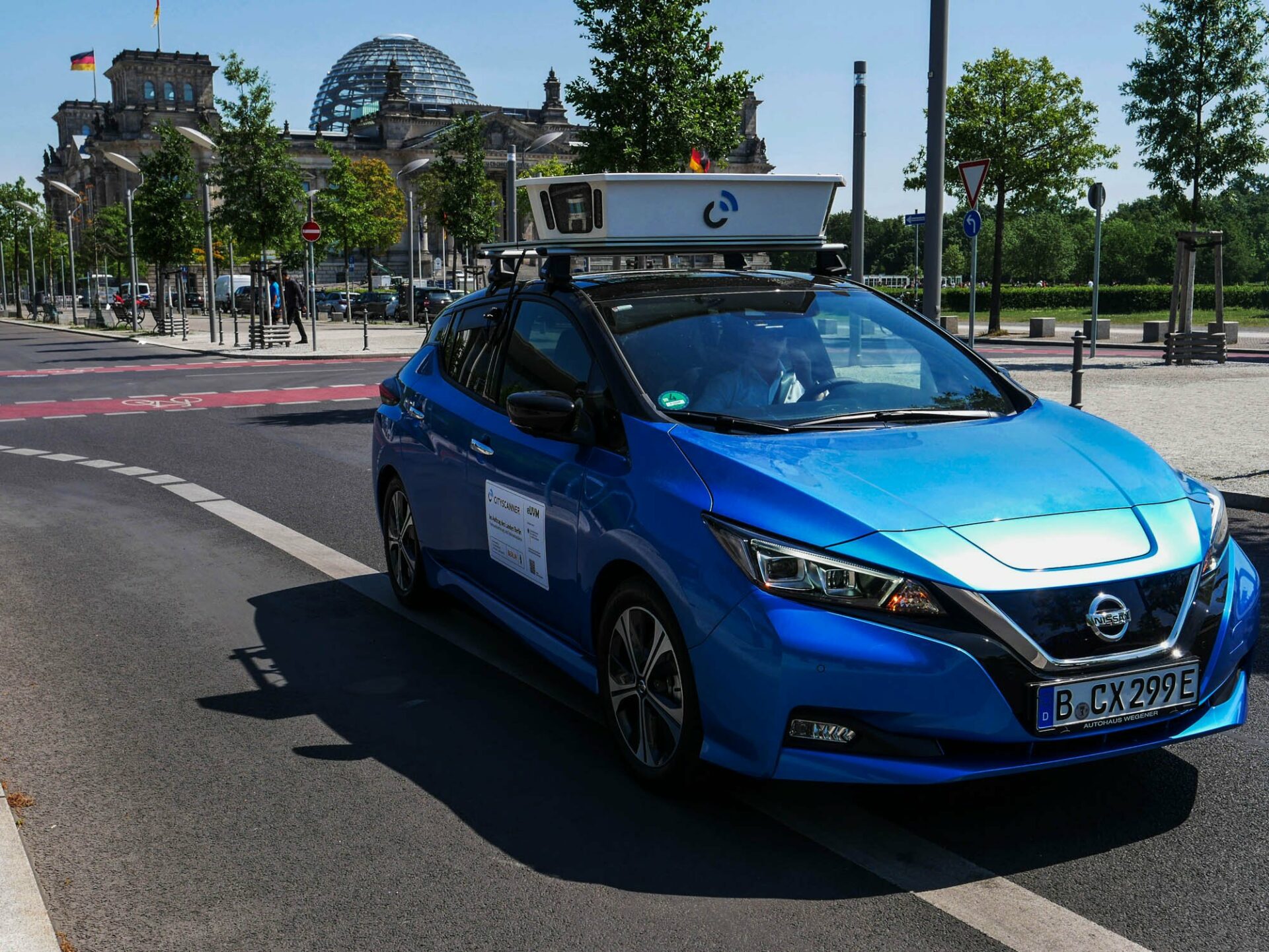
Four cars equipped with the latest CITYSCANNER® system drive through the selected area – one car a day covers up to 160 km of the route. Vehicles in motion record the roadside with high-resolution cameras, LiDAR laser scanners and GPS.
In order to draw conclusions about the duration of a stop and the parking space search traffic, partial data from the license plates of parked and moving vehicles are collected and analyzed.
Data processing and full anonymization of pedestrians and vehicle registration plates in the image data takes place already in the vehicle – the registration of public parking spaces under this project is solely for analytics and is not used to control or punish parking violations.
The data collected during the project is analyzed in terms of:
- The quantification and location of parking spaces or the potential change of their intended use
- The volume of traffic related to searching for parking space depending on the availability of parking lots, their use, day of the week and time
- Calculating the impact of traffic on the use of parking spaces
- The influence of the pricing policy on the use of places
- Effects after introducing changes in the management of parking space
Planned project completion date – December 2023.